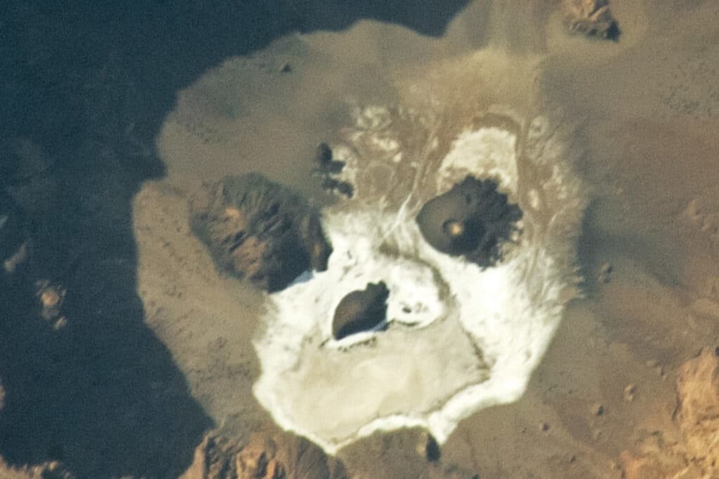
NASA has unveiled a stunning, yet spooky image snapped by an astronaut aboard the International Space Station earlier this year. The photo reveals a natural formation resembling a ghostly face peering up from the Earth’s surface. But this is no spectral illusion; it’s a rare glimpse into our planet’s dynamic geology.
The striking geographical feature seen from space is actually from an area in northern Chad known as Trou au Natron, which is a volcanic crater, or caldera. Its formation is a story written in the language of volcanic eruptions and geological transformations.
When volcanoes erupt explosively, they can sometimes empty their underlying magma chamber to such a degree that the ground above collapses, creating a caldera. The edges of this caldera, often cliff-like and imposing, cast shadows that, from the right angle, appear to outline the contours of a colossal face.
The features that seem to serve as the “eyes” and “nose” of this facial formation are known as cinder cones. These are the results of volcanic vents ejecting particles of lava into the air, which then fall back to Earth around the vent, creating steep, conical hills. In geological terms, the cinder cones of Trou au Natron are considered infants, having emerged only a few million years ago, and some possibly as recently as a few thousand years ago.
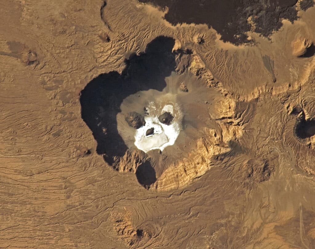
Circling what one might whimsically call the “mouth” of the face is a white expanse made of a mineral crust. This is natron, a salt composite that originates from evaporated hot spring water. As the geothermal waters rise to the surface and then evaporate, they leave behind a mixture of salts, including sodium carbonate and sodium bicarbonate. This process creates a distinctive crust around areas where geothermal activity is high.
Adjacent to Trou au Natron is the Tarso Toussidé volcanic region, known for its active stratovolcano and fumaroles – vents that emit steam and gases as a testament to the ongoing volcanic activity beneath the surface.
The remote nature of Trou au Natron has made it a challenging site for scientific study. Yet, despite this, researchers have been able to uncover fascinating details about its past. Rock and fossil samples from the 1960s suggest that some 14,000 years ago, the area was submerged under a deep glacial lake. More recently, an expedition in 2015 gathered samples that indicate the presence of aquatic algae from approximately 120,000 years ago, offering a window into the region’s ancient climate and ecology.
Piecing together the volcanic history of the area, researchers from the University of Cambridge have used satellite data, particularly from NASA’s Terra satellite equipped with the ASTER sensor, to identify six distinct phases of volcanic activity in the Tibesti Mountains, with the birth of Trou au Natron being one of the more recent geological events.
This photograph from the International Space Station not only provides a unique visual treat but also underscores the importance of satellite technology in studying and understanding Earth’s less accessible regions. As we look up to the stars, it’s fascinating to reflect on how much we can learn about our own planet from a perspective that spans the vastness of space.
